Object Lesson: Rees-Jones Globe
Illuminated Learning
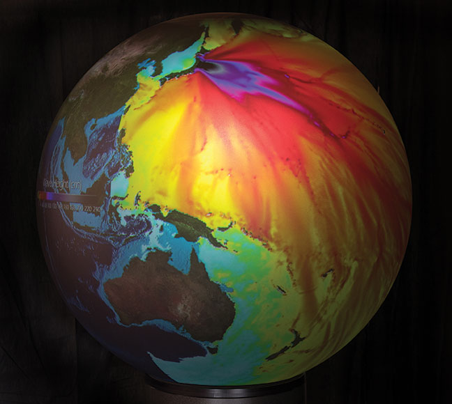
A map projected onto the globe in Rees-Jones Hall displays wave heights during the 2011 Japan Tsunami.
Object Lesson: Rees-Jones Globe
Illuminated Learning
More than 7 feet tall and weighing 270 pounds, the 870-watt OmniGlobe is the centerpiece of Rees-Jones Hall’s second floor. The globe is actually an illuminated spherical map that displays changing images created by multiple high-definition projectors.
Arriving pre-loaded with 200 geospatial data maps from NASA, the National Oceanic and Atmospheric Administration and the U.S. Geological Survey, the globe has a touch-screen panel that allows users to toggle between displays of carbon levels, vegetation patterns and the effects of natural disasters on the earth. The data also includes maps of the eight planets, the sun, the moon and the Milky Way galaxy.
TCU is creating its own maps, too. Under the direction of Tamie Morgan, professor of professional practice in geology, faculty and their students have constructed 12 displays on pollution, continental drift, forestation and other topics.
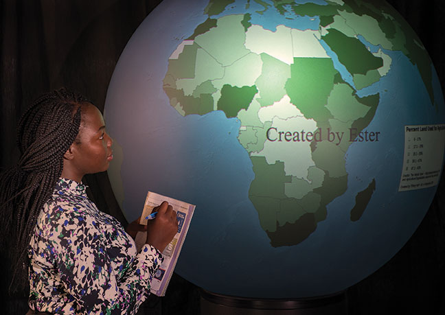
Ester Chitsinde ’14 created a map of agricultural land use for a geology class.
Your comments are welcome
Comments
Related reading:
Features
Our Marching Band, the Pride of TCU
In its 111th year, the band still practices hard, relies on teamwork and performs with passion.
Features
Kelubia Mabatah’s Comeback
Former TCU tennis player forges on after a traumatic brain injury.